























More storms on the way

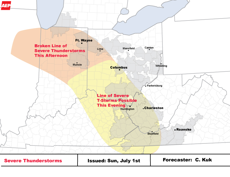
AEP provided the following weather alert at 2:30 p.m. on Sunday
*** Broken Line of Severe Thunderstorms For I&M Power This Afternoon
*** Line of Severe Thunderstorms Possible for Portions of AEP Ohio,
Kentucky Power, W.
The latest radar as of 2:30 pm shows a broken line of severe thunderstorms in northern Illinois entering Indiana.
This broken line of
severe storms will continue to track to the east over the next couple of
hours. There is also the potential for these severe storms to persist and
evolve into another line of severe storms with plenty of instability in
place. If further organization occurs... significant damaging winds will
once again be possible.
The uncertainty in whether this develops into a
line is do to best upper level energy racing out ahead of this broken line.
The line of severe storms is most likely to track to the southeast once it
enters Ohio and impact portions of AEP Ohio, Kentucky Power and APCo this
evening and into tonight. Wind gusts in excess of 60 mph is expected with
these storms.