


University presents exhibition featuring maps created, utilized during Hurricane Katrina
CURATED BY HARRY "JIMMY" WILSON
A reception and talk with Wilson will take place in room 115 of the Wilson Art Center on Friday, Oct. 16, at 6:30 p.m. Refreshments will be served in the lobby of the Elzay Gallery.
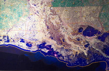
The Ohio Northern University Department of Art and Design presents Mapping Katrina, dynamic visual documentation of New Orleans before, during and after Hurricane Katrina, in the Elzay Gallery of Art from Oct. 16 to Dec. 13.
This exhibit features numerous maps created and utilized during the natural disaster in 2005. It features a stunning visual display of topographical, statistical, and geographical information that was gathered during the storm.
The exhibit was curated by Harry “Jimmy” Wilson, ONU assistant professor of management and geographical information systems.
Wilson has diverse work experience in private, government and education sectors that includes specializations in geographic information systems (GIS), disaster science, cultural resource management and archaeology. He worked at the Louisiana Department of Transportation and Development during Katrina as a cartographer and GIS specialist while pursuing his Ph.D. in geography from Louisiana State University, which he earned in 2007.
He has taught at ONU since 2007 and recently transferred to the Dicke College of Business Administration to teach information systems and GIS for business courses.

Stories Posted This Week
Wednesday, July 15, 2026
- Ohio EPA issues Air Quality Advisory due to Canadian wildfires
- UPDATE July 15 boil water advisory lifted for 700-800 blocks of S. Johnson St.
- Murder trial of Donna Jo Miller postponed until December
- June 2026 Hardin County rainfall reports
- Sept. 22-24 Farm Science tickets on sale
- Beatitudes serves 136 meals on 4th of July
Tuesday, July 14, 2026
Monday, July 13, 2026
- Youth swimming & stroke clinic with AHS Swim Team, July 23-26
- Ada Municipal Pool opens early for adults with children
- Letter: Hollar reflects on 4+ years spent as Ada chamber director
- 2026 Ohio Sales Tax Holiday is August 7-9
- Public meeting audio recorders wanted for Liberty, Orange and Richland townships
- August 5 National Night Out celebration at War Memorial Park